Cable Corridor
Cable Corridor
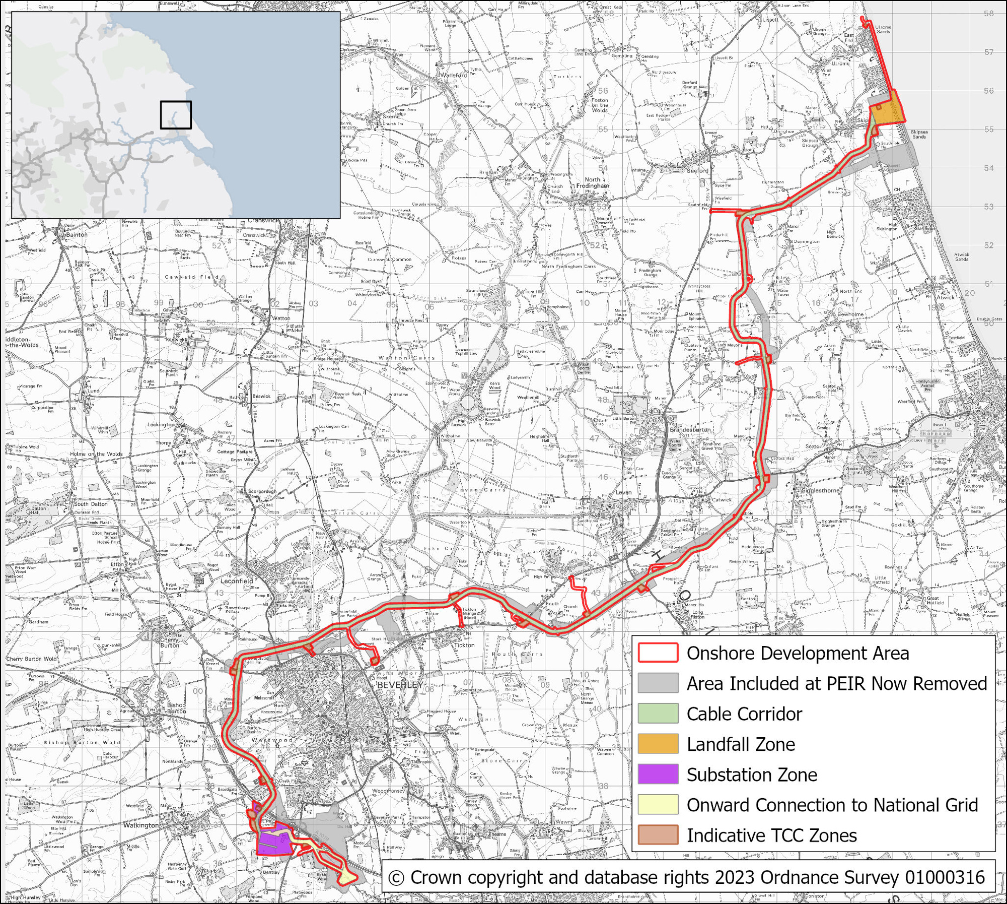
The onshore cable corridor connects the landfall point near Skipsea to two converter stations, located to the south of Beverley, for transmission into the national grid.
Taking into consideration consultation feedback, environmental surveys and ongoing engineering work, we have refined the cable route from the landfall to the converter stations.
The cable corridor width has reduced from 100m presented in the Preliminary Environmental Information Report to 75m, widening to 90m at Horizontal Directional Drilling locations.
The preferred route has the following advantages: -
Works with existing proposals for a new wind turbine at Dunnington;
- Reduces the potential to sterilise safeguarded mineral reserves at Long Riston;
- Mitigates potential impacts on a proposed solar farm at Riston Grange;
- Provides alternative access at Routh, avoiding a poultry farm;
- Avoids the application for a proposed recycling centre at Molescroft;
- Avoids the designated landscape at Westwood Common;
- Avoids significant heritage assets identified around Nunkeeling Priory.
The width of the 400 kilovolt (kV) cable corridor from the converter stations to National Grid has been refined to 100m. A section of this cable corridor splits with one route north of the Ineos ethylene pipeline and one route south of the pipeline. The width of each split section is 53m, which accommodates the haul roads.
Map of onshore cable corridor

Image showing how onshore cables are laid.